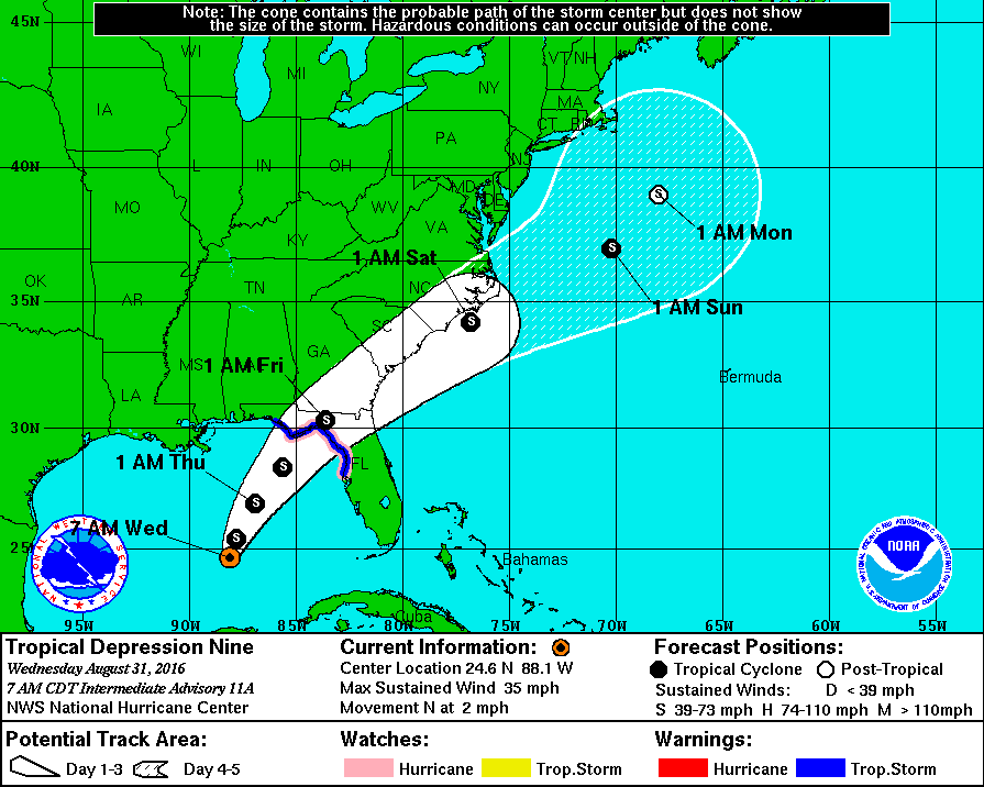
It seems like its been a few years since we’ve had to deal with a storm event in south Georgia this time of year but it looks like we could have one now. The slow moving tropical storm presently churning slowly in the Gulf is scheduled to make landfall in the bend of Florida at 1 am Friday unless its course continues to change (as it has over the last few days). As I write this, south Georgia from about Tifton southward has a 40-60% chance for tropical storm force winds (39 mph). The Southeastern corner of the state looks to be the most threatened at this time. This is enough to potentially have a serious impact on our crop by pushing trees over and breaking a lot of limbs as heavily loaded as most trees seem to be.The track of this storm could change by the time it makes landfall. Wherever it goes, hopefully we won’t see it strengthen. It would be wise for growers to turn off irrigation systems at this point to allow the soil to dry as much as possible in order to prevent trees from blowing over. Keep track of the storm at the following website: https://www.nhc.noaa.gov/refresh/graphics_at4+shtml/093741.shtml?tswind120#contents