Today there is a large tornado outbreak underway in Louisiana, and the system is moving east and will affect our area on Monday. The screen capture of today’s radar below shows not only a strong line of severe storms moving through Louisiana today but multiple individual supercell thunderstorms ahead of the line. Many of these supercells have tornado warnings associated with them. There have been at least two deaths associated with this outbreak already from an overturned mobile home this morning, and it would not surprise me if more occurred.
This outbreak has a high chance of producing multiple tornadoes as well as damaging winds, hail and heavy rain. Whether you are staying in or planning to be out and about on Monday, you need to make sure that you have multiple ways to get severe weather warnings. Many smartphones now provide weather warnings based on location, and there are a number of apps that also provide notice if a watch or warning is issued. If you have access to a NOAA weather radio, make sure that it is turned on and working. Don’t rely on sirens, because they are hard to hear if you are indoors and many communities don’t have them anyway.
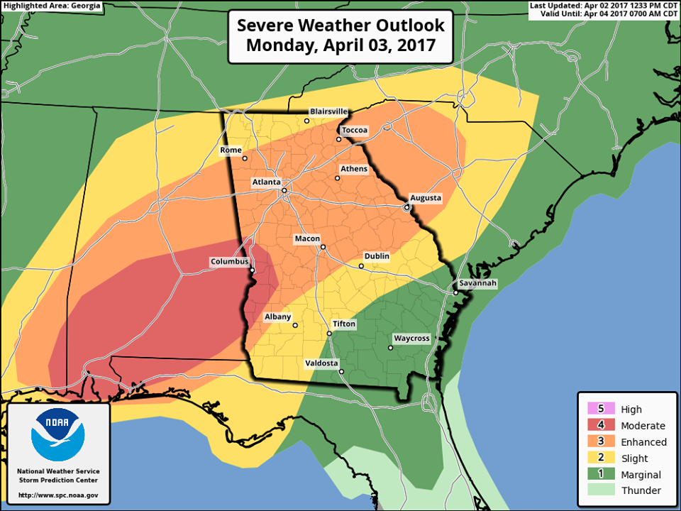
The timing map below was put out by the NWS office in Peachtree City, GA and covers their warning area. If you live in a different location, be sure to check your local NWS office site for information on your area. Note that there is also a chance of severe weather on Wednesday April 5.
Here are some links discussing this weather outbreak and tornado safety:
Beatrice Daily Sun: Severe storms in the forecast for US for much of this week
MSN: 6 life-threatening tornado myths debunked
NOAA Storm Prediction Center: Tornado safety FAQs