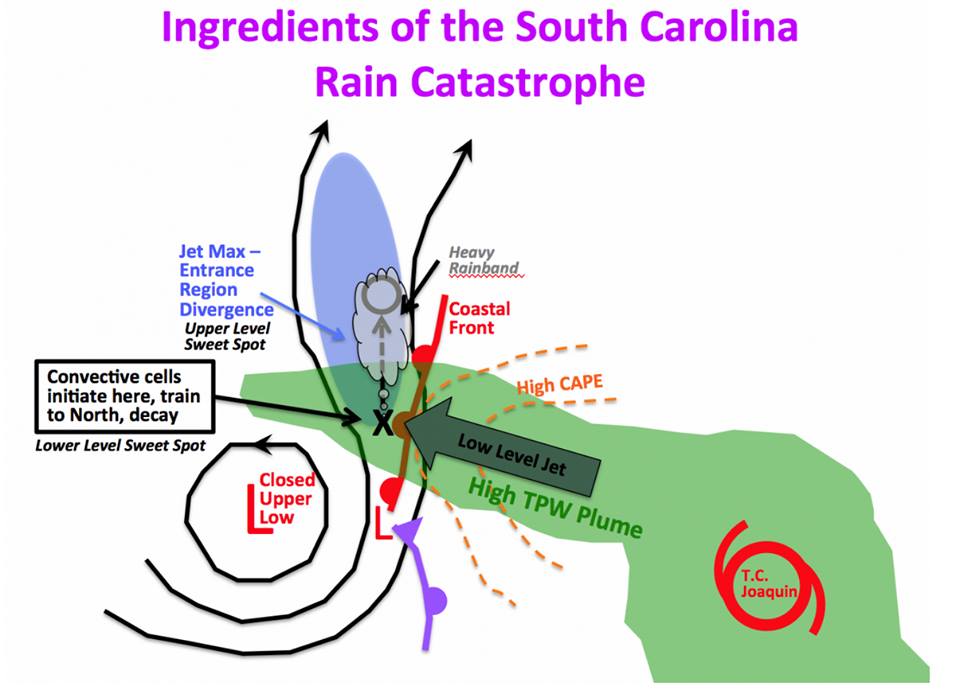
The South Carolina State Climate Office, in conjunction with other cooperators, has released an online story map of the disastrous flooding in October 2015 that has won several awards for its report. You might like to take a look at it. It contains information about the setup for the flood, which included the impacts of an offshore hurricane, the rainfall totals from the storm, and a summary of the impacts of the flood, along with lots of pictures. You can find it at https://scdnr.maps.arcgis.com/apps/MapJournal/index.html?appid=bc1ea6edf5eb495189be4968e0cd0edb.