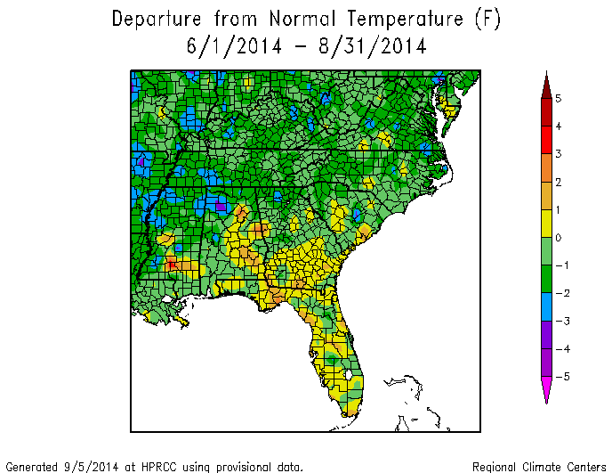
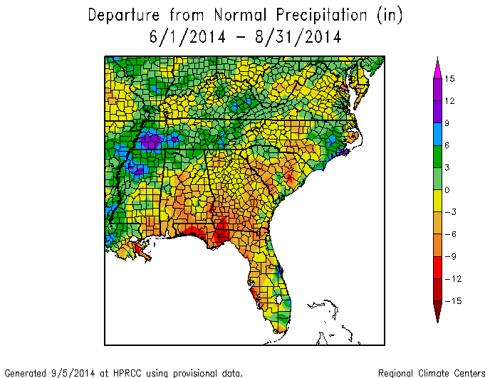
Georgia was close to normal in temperature for summer 2014. Most stations reported temperatures within one degree of normal, with slightly below normal temperatures dominating in the wetter northern half of the state and slightly above normal temperatures occurring in the drier southern half. Precipitation amounts were drier than normal across most of the state, with the driest spots in southwest Georgia. The lower than normal rainfalls in the southern part of the state have led to the development of a severe drought in a few areas, and moderate drought and abnormally dry conditions have spread to many parts of Georgia over the past few months.
For fall, NOAA has reduced its forecast for El Nino to develop to 60-65 percent, down from 80 percent earlier this summer. The equatorial Pacific Ocean showed promise for a strong El Nino to develop early in the summer, but the atmosphere has not linked with the oceanic warm pool and so now at best a weak El Nino is expected to develop. This means that the predictions for climate conditions in the next few months are less certain, since El Nino is the strongest driver of climate variability in the Southeast.
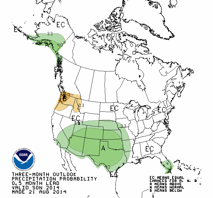
The outlook for fall reflects the uncertainty in the El Nino forecast. Temperatures in the east have a slightly increased chance of above normal conditions, while wetter than normal conditions are most likely in the southern tip of Florida. If the tropics continue to be quiet, then the fall may well be drier than normal across the entire Southeast.

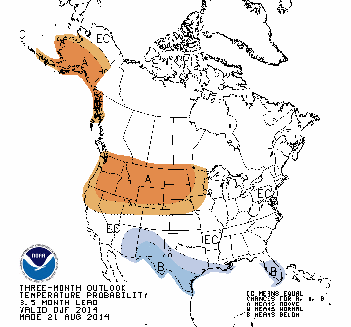
For winter, the uncertainty about El Nino and the likelihood that if one occurs it will be weak mean that the cool and wet conditions we usually expect with El Nino in the Southeast are probably going to be confined to Florida and along the Gulf Coast.

Outlooks beyond winter show equal chances of above normal, near normal and below normal across the Southeast. To view these maps, visit https://www.cpc.ncep.noaa.gov/products/predictions/90day/ to get updated seasonal forecasts. This latest forecast of a weak El Nino is not good for California farmers, either, since El Ninos typically bring good rains to the state. This is particularly important this year when they are in an exceptional drought. You can read a story about El Nino and California climate from SFGate.com by clicking here.